
Guidance
Drawing plans
Detailed plans are an essential part of any planning application. This page offers basic guidance on drawing suitable plans. For specific questions, major works and development plans, please consider our Planning advice services
Plans for a home extension or conversion
Here are 10 tips to help you in drawing accurate plans for individual home projects.
- Include all elevations and floor plans
- Highlight new work using colour or hatching
- Each plan must be drawn to a metric scale, which should be stated. Any dimensions should be included on the plans in metres
- Use dotted or broken lines to show the position of existing buildings to be demolished
- Outline your site in red on the location plan (for more detail, see our Location plan section below)
- Make sure the position of adjacent properties is accurate on the block plan and show the siting of the proposed work in red or hatching (all copies must be drawn to scale)
- Show the precise position of the boundary
- Trees to be retained or felled should be shown
- Mark up the drawings to show what building materials are proposed
- Show the north point on the plan
Location plan and red lines
A Location Plan for your proposals must meet the following requirements:
- It should be in an identified standard metric scale (typically 1:1250 or 1:2500 for larger sites) and show the direction North.
- Plans should be scaled to fit onto an A4 size document.
- Plans should identify and name sufficient roads and/or buildings on land adjoining the application site to ensure that the exact location of the application site is clear.
- The application site should be edged clearly with a red line and it should include all land necessary to carry out the proposed development – for example, land required for access to the site from a public highway, visibility splays, landscaping, car parking and open areas around buildings.
- A blue line should be drawn around any other land owned by the applicant, close to or adjoining the application site.
- Both the red and blue lines must be continuous and not broken.
- In the example below, a private/non-adopted road runs from the site leading to the public highway. The site area has been edged in red and continues along a private/non- adopted road also edged in red. Where the private/ non-adopted road red edging stops, that is where the public highway begins. In these examples the private/non-adopted road is required to access the site.
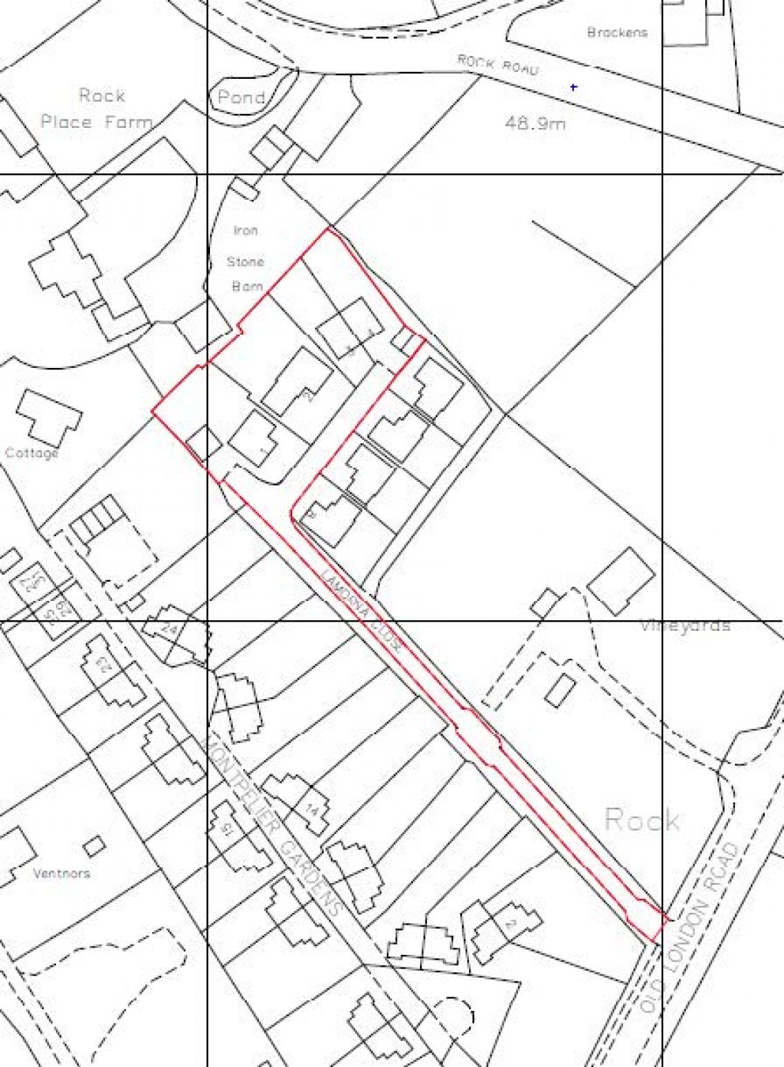
The site has been edged in a block red line and continues along a private or non-adopted road. The line stops where the public highway begins.